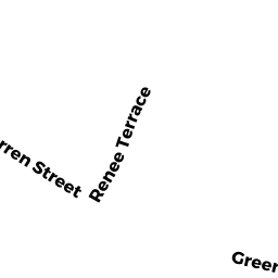
11 RENEE TER
Owner Information
MORGAN ROBERT L & LOIS H L/E
11 RENEE TER
NEWTON, MA 02459


Property Details
11 RENEE TER is classified as a Single Family Residential (Raised ranch).
The primary structure on this property was built in 1963. There are 4,130ft2 of built area within this property. There is 1,990ft2 of residential/living space within this property. This property is listed as having 9 rooms.
11 RENEE TER is valued at $888,600. The land is valued at $646,400 and the structures are valued at $242,200.
This property is in Zone SR2. Confirm with local Zoning Board authorities to ensure there are no overlays or other easements on this property.
The most recent deed for 11 RENEE TER is recorded at the local registrar in Book 46512, Page 190. 11 RENEE TER was last sold on Monday, November 21, 2005 for $100.
Assessment data from fiscal year 2022.
Flood Data
According to the FEMA National Flood Hazard Layer, this property does not appear to be in a flood zone. It may also be in an area not yet reviewed. Nonetheless, confirm this information prior to taking any action.
To view the flood hazards around this property, create a FEMA "Firmette" Map of the area around 11 RENEE TER.
Broadband Internet Providers
| Provider | Type | Bandwidth (mbps) | |
|---|---|---|---|
| RCN | Cable | 25 | 4 |
| VSAT Systems, LLC. | Satellite | 2 | 1 |
| HughesNet | Satellite | 25 | 3 |
| GCI Communication Corp. | Satellite | 0 | 0 |
| T-Mobile | Fixed Wireless | 25 | 3 |
| RCN | Cable | 1000 | 20 |
| Viasat Inc | Satellite | 100 | 3 |
| Verizon New England Inc. | DSL | 5 | 0 |
| Verizon New England Inc. | Fiber | 940 | 880 |
| Comcast | Cable | 1000 | 35 |
| RCN | Cable | 500 | 20 |
Broadband service provider data from December 2020.
Adjacent Properties
- WARREN ST
CITY VACANT LAND owned by CITY OF NEWTON - 21 RENEE TER
Single Family Residential owned by YONG TSEH-HWAN - 45 WARREN ST
Other, Open Space owned by 45 WARREN ST MASTER DEED - 45 WARREN ST 1
Residential Condominium owned by ROBINSON AMY - 45 WARREN ST 2
Residential Condominium owned by ROBINSON DASHIELL - 53 WARREN ST
Single Family Residential owned by LANDRY MICHAEL & JILLIAN